 Bắc Ninh


Tropical depression expected to strengthen into storm, threatening northern Vietnam with severe rainfall
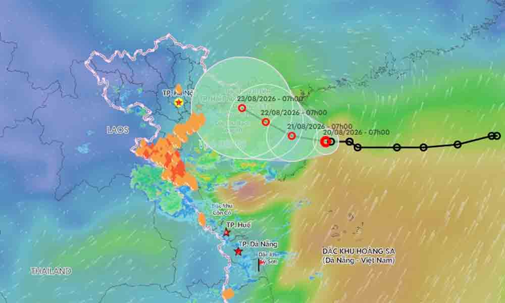
A slow-moving tropical depression over the Gulf of Tonkin is forecast to strengthen into a tropical storm by Friday, threatening northeastern Vietnam and Thanh Hoa Province with heavy downpours and raising the risk of flooding, flash floods, and landslides.
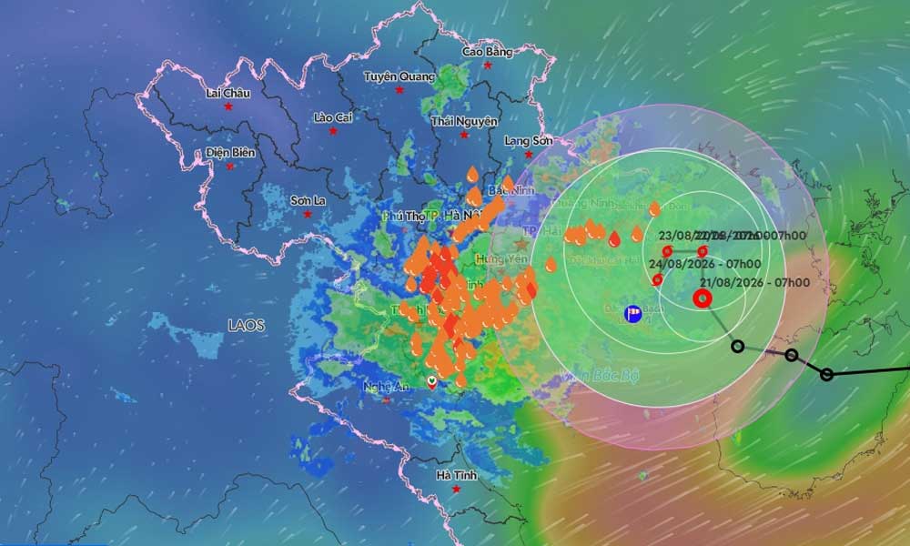
According to the National Center for Hydro-Meteorological Forecasting (NCHMF), the depression was located approximately 100 km east of the Bach Long Vi special zone at 7 a.m. Thursday.
 |
|
The predicted trajectory of a tropical depression near the Gulf of Tonkin. |
The system was packing maximum sustained winds of 61 kph, with gusts reaching up to 88 kph, while moving northwest at a 5 kph.
Meteorologists expect the system to intensify into a tropical storm by 7 a.m. on Saturday.
At that time, it is projected to be about 190 km east of Hai Phong and 120 km northeast of Bach Long Vi. Sustained winds are forecast to increase to between 61 and 74 kph, with gusts topping 102 kph.
The storm's trajectory is expected to be erratic. Initial forecasts suggest it will move slowly northward before pivoting west at 3 to 5 kph through Saturday morning. Over the subsequent 48 to 72 hours, the system may reverse course and drift slowly southward.
The Hong Kong Observatory noted that the cyclone could take a highly complex track, lingering and strengthening over the Gulf of Tonkin rather than making a direct landfall in Vietnam.
The weather system is already making a significant impact. Combined with an upper-level wind convergence at an altitude of 5,000 meters, the depression brought heavy rain and thunderstorms to northeastern Vietnam and north-central coastal areas.
Rainfall totals over a 13-hour period (as of Friday morning) exceeded 100 mm in several areas. Ban Hang Doi in Phu Tho Province recorded 155 mm, while Thanh Ha in Hanoi saw 122 mm, and Vinh Thinh in Thanh Hoa Province received 109 mm.
The deluge is expected to continue.
The NCHMF warned that northeastern provinces, including Quang Ninh, Hai Phong, Hung Yen, Ninh Binh, and Thanh Hoa, will see an additional 70 to 150 mm of rain from now until late Saturday night.
Isolated areas could receive more than 300 mm, with torrential downpours potentially dumping over 120 mm in just a three-hour window.
The Central Highlands and southern Vietnam are bracing for separate weather disruptions. These regions are expected to receive 15 to 30 mm of showers and thunderstorms throughout Friday, with localized areas seeing over 60 mm, primarily in the late afternoon and evening.
Authorities are urging residents across affected regions to prepare for potential tornadoes, lightning strikes, and strong wind gusts.
The intense rainfall poses a severe threat of flash floods along rivers and streams, landslides on steep slopes, and significant flooding in low-lying urban areas and industrial parks.
Since the start of the year, the East Sea, internationally known as the South China Sea, has recorded two major storms.
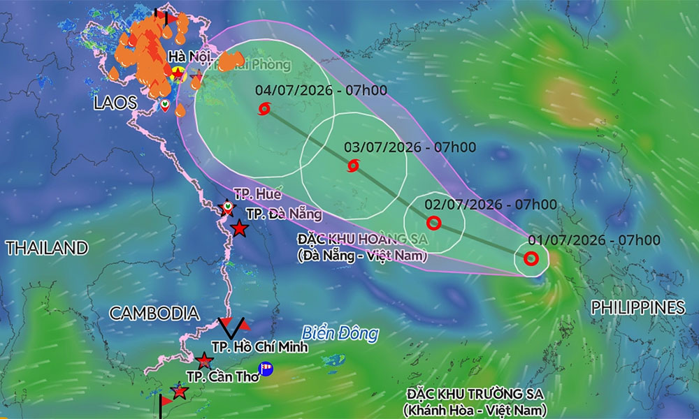
On July 1, a tropical depression formed over the central sea and strengthened into Typhoon Maysak.
As the first storm of the year, Maysak generated sustained winds of 75 to 88 kph and gusts up to 117 kph. It made landfall in Quang Ninh Province, home to Ha Long Bay, on the evening of July 4, packing winds of up to 74 kph.
On July 23, another depression strengthened into Typhoon Noul, the year's second storm off Vietnam's coast. It moved toward Guangdong, China, bypassing the Vietnamese mainland.
The meteorological agency anticipates that tropical storm and depression activity over the East Sea will remain broadly in line with long-term averages from July through September.























Reader's comments (0)