 Bắc Ninh

Storm Wipha enters South China Sea, heads for northern Vietnam
Storm Wipha has entered the South China Sea and is gaining strength as it heads toward Vietnam’s northern coast, with landfall expected early next week.
Vietnam’s national weather agency said the storm, packing winds of 88 kph, is moving northwest at 20 kph. By July 20, Wipha is forecast to intensify over the northern South China Sea, about 600 kilometers from China’s Leizhou Peninsula.
 |
|
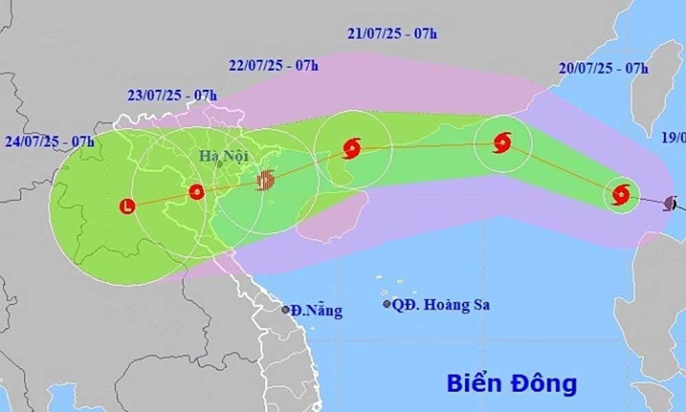
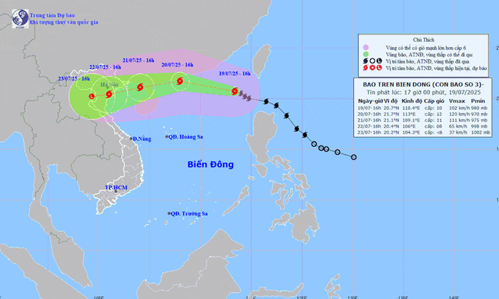
An illustration of Typhoon Wipha's trajectory on July 19, 2025. |
By July 21, the storm will near the Leizhou Peninsula and shift westward into the Gulf of Tonkin. It is expected to weaken slightly after brushing China’s coast, before turning southwest and making landfall between Quang Ninh and Hai Phong on July 22.
Japan’s Meteorological Agency expects Wipha to peak tonight and tomorrow with winds of up to 108 kph, while Hong Kong’s weather service predicts maximum winds of 130 kph.
The typhoon is projected to weaken to around 90 kph as it crosses the Gulf of Tonkin and slams into Vietnam.
In the northeastern South China Sea, winds are strengthening and waves are rising to 4-6 meters, posing risks to ships operating in the area.
At an emergency meeting on July 19, Vietnam’s Ministry of Agriculture and Environment warned that Wipha’s path is similar to that of Typhoon Yagi. While Wipha’s winds may be weaker, officials cautioned it could unleash heavy rains across northern Vietnam.
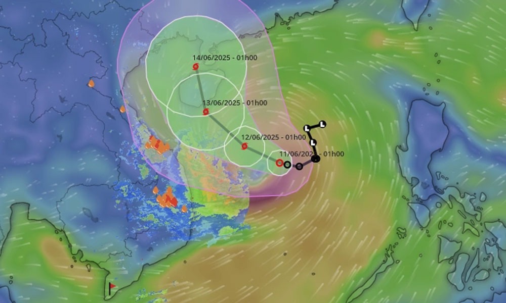
Wipha is the third typhoon to hit the South China Sea this year. In June, Typhoon Wutip triggered floods across central Vietnam, killing 11 people and submerging more than 3,500 homes.


Reader's comments (0)