 Bắc Ninh

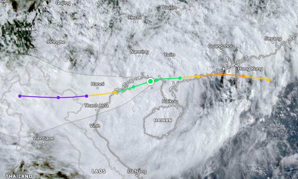
Storm Wipha weakens into tropical depression after landfall in northern Vietnam
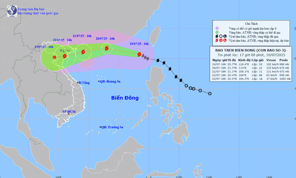
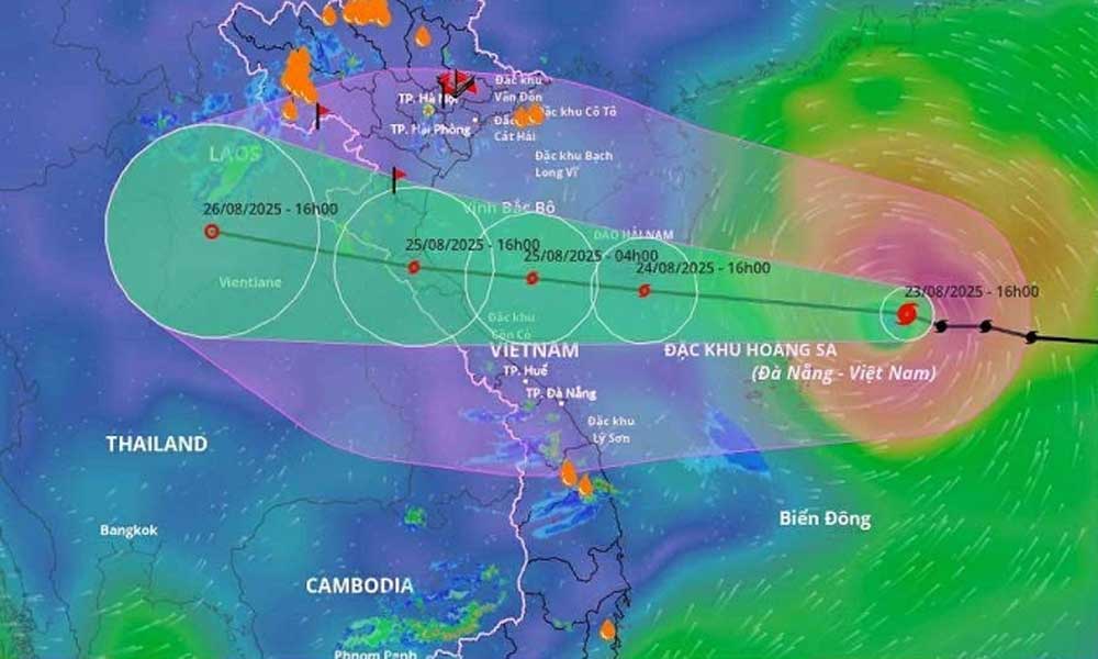
Nine hours after making landfall between Hung Yen and Thanh Hoa provinces in northern Vietnam, Storm Wipha weakened into a tropical depression at 7:25 p.m. Tuesday, but continued to bring heavy rain.
According to the National Center for Hydro-Meteorological Forecasting, the tropical depression recorded sustained wind speeds of 50–61 kph, with gusts reaching 75–88 kph in areas across Ninh Binh and Thanh Hoa provinces.
 |
|
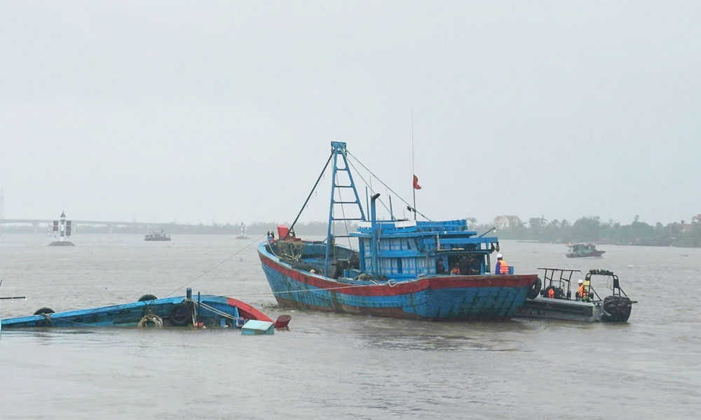
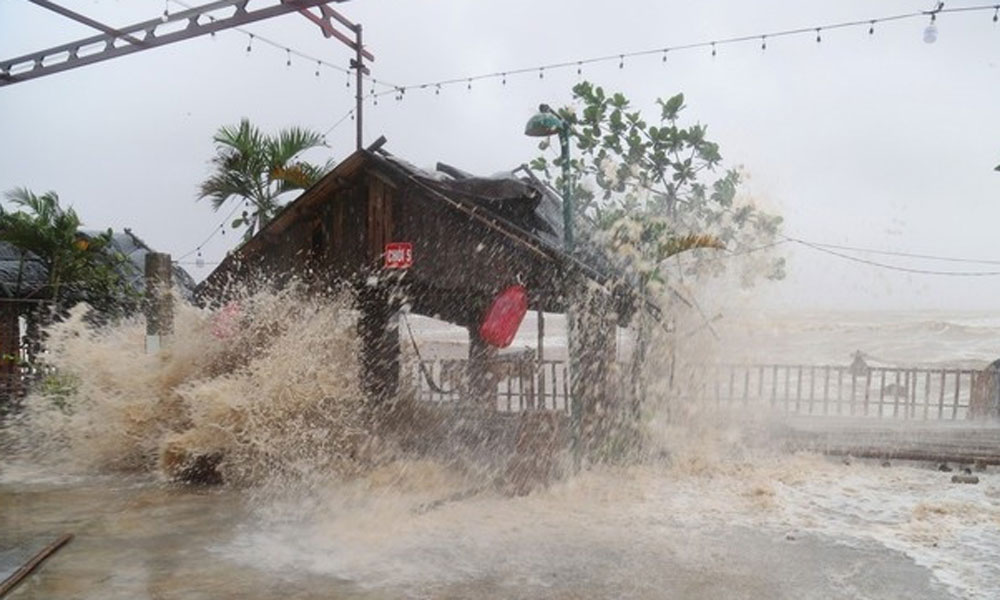
Storm Wipha toppled a fishing boat on the Chanh River in Quang Ninh Province, July 22, 2025. |
Explaining why the storm, despite not being particularly strong at landfall, maintained level high intensity for nearly nine hours, Nguyen Van Huong, head of the center’s Weather Forecasting Department, said Wipha was fueled by the tropical convergence zone, which helped sustain its energy.
He added that when the storm first entered the East Sea (known internationally as the South China Sea), it was pushed along quickly by the subtropical high ridge. But as it entered the Gulf of Tonkin, the ridge weakened, causing the storm to slow down.
"Since Tuesday afternoon, Wipha has been moving very slowly," Huong added. "Because it didn’t move far inland, it retained its strength longer, resulting in extended periods of strong coastal winds."
From 1 p.m. Monday to noon Tuesday, Wipha brought strong winds to coastal areas in northern and north-central Vietnam. The highest wind speeds on land were recorded at Tien Yen station in Quang Ninh Province, at 89–102 kph. Other coastal stations in the province also reported intense winds.
Elsewhere, Thai Binh saw 50–61 kph winds; Ba Lat in Hung Yen and Hon Dau in Hai Phong at 62–74 kph.
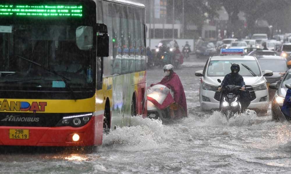
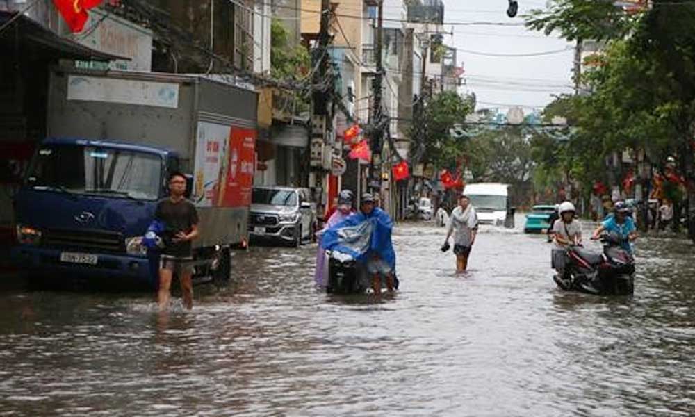
Between 7 a.m. Monday and 1 p.m. Tuesday, Wipha dumped 100–200 mm of rain across northern provinces, Thanh Hoa, and Nghe An—with many areas exceeding 300 mm.
The highest rainfall was recorded in Nga Son (Thanh Hoa) at 412 mm, followed by Sam Son (379 mm), Trieu Son (336 mm), and Nhu Thanh (327 mm). Stations Hai Anh, Giao Linh, and Tam Diep in Ninh Binh Province each recorded over 260 mm.
The storm also triggered sea waves up to 3.5 meters high at Bach Long Vi Island (Hai Phong) at 7 p.m. on Monday and 2.5 meters at Co To Island (Quang Ninh) at 7 a.m. on Tuesday morning. Storm surges reached 0.6 meters at Hon Dau (Hai Phong) and 0.8 meters at Ba Lat (Hung Yen) around 10 a.m.
Although Wipha has weakened, its remnants and the tropical convergence zone are expected to continue bringing widespread rain. Forecasts predict 20–40 mm of rainfall in Lao Cai, Son La, and Ha Tinh, with localized totals exceeding 70 mm.
Heavier downpours of 40–60 mm, potentially surpassing 180 mm in some areas, are expected in Thanh Hoa, Nghe An, and southern Phu Tho. These areas, particularly mountainous regions in Thanh Hoa and Nghe An, also face a high risk of flash floods and landslides.
So far this year, three storms have formed in the South China Sea, with two impacting Vietnam. Meteorologists expect around seven more storms to develop by October, three of which are likely to reach mainland areas.
As of 5 p.m. Tuesday, the Vietnam Disaster and Dyke Management Authority reported that nearly 11,800 people had been evacuated due to Storm Wipha. This includes nearly 5,000 evacuees in Hai Phong and over 4,700 in Ninh Binh. An additional 730 people in Thanh Hoa and Nghe An were displaced due to flooding and landslide threats.
Preliminary damage assessments show 79 houses in Nghe An had their roofs blown off. More than 107,000 hectares of rice fields were flooded, with Ninh Binh accounting for over 74,000 hectares. Several dike failures were also reported in Da Phuc Commune in Hanoi, Nghia Son Commune in Ninh Binh, and Hoang Chau Commune in Thanh Hoa.


Reader's comments (0)