 Bắc Ninh

Typhoon Koto weakens, heading for south-central Vietnam
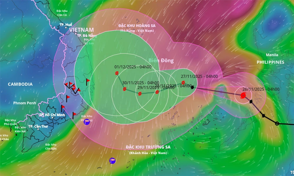
Typhoon Koto has weakened, slowed, and shifted slightly southward, but is forecast to turn north again and approach flood-hit Gia Lai Province around Dec. 1–2.
According to the National Center for Hydro-Meteorological Forecasting, the storm lay centered about 240 km northwest of Southwest Cay Island in the Spratly archipelago at 4 a.m. Friday, with maximum sustained winds of 117 kph. Koto was moving west–southwest at around 5 kph.
 |
|
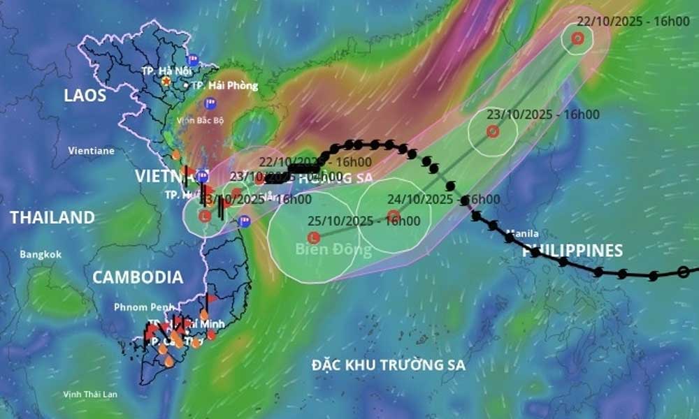
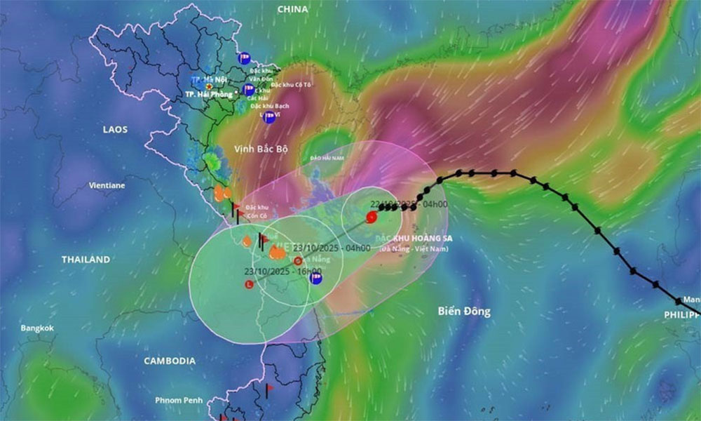
The predicted trajectory of Typhoon Koto. |
By 4 a.m. Saturday, it is projected to be over the western part of the central East Sea, about 260 km northwest of Southwest Cay, with winds weakening to 89–102 kph as it shifts west at about 3 kph.
By early Sunday, the typhoon is expected to enter the northwestern area of the central East Sea, roughly 300 km east of Gia Lai’s coast, maintaining winds of 88–102 kph while moving northwest at 5 kph.
By 4 a.m. on Monday, Dec. 1, Koto will likely remain in the same general region, about 210 km east of Gia Lai’s coastline, with winds dropping to 75–88 kph as it continues northwest at 3–5 kph.
Japan Meteorological Agency reported Friday morning that the storm was producing winds of about 108 kph and drifting southward before an anticipated turn to the north.
The agency forecasts that Koto will weaken further, reaching around 65 kph upon making landfall in Gia Lai on Dec. 2. Hong Kong Observatory also expects the typhoon to lose strength as it tracks north, predicting landfall in northern Gia Lai.
The storm is expected to bring hazardous conditions to offshore waters from Gia Lai to Khanh Hoa provinces in south central Vietnam, with winds of 39–74 kph and waves reaching 5–7 m. Authorities warn that vessels operating in these areas may face dangerous weather.
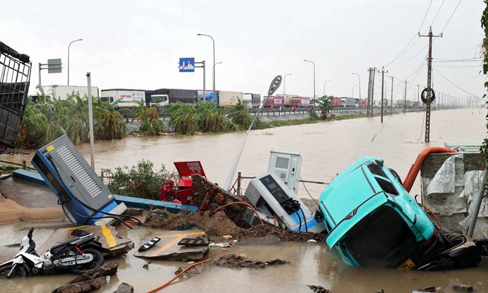
The region is still recovering from week-long flooding that began in mid-November, which left 98 people dead.
Hoang Phuc Lam, deputy director of the National Center for Hydro-Meteorological Forecasting, said the storm’s movement is being shaped by the weakening subtropical ridge.
As the ridge loses influence, its steering effect diminishes, and the storm drifts farther west and away from the ridge, prompting a northward shift.
Koto formed from a tropical depression east of the central Philippines before strengthening into a typhoon and entering the East Sea on Nov. 25. It is the 15th storm in the region this year. In 2025, storms and floods have caused 409 deaths, 727 injuries, and more than VND85 trillion (US$3.2 billion) in economic losses.


Reader's comments (0)